
Canada’s Top Ten Weather Stories of 2019
– By David Phillips, Environment and Climate Change Canada (article source: https://www.canada.ca/en/environment-climate-change/services/top-ten-weather-stories/2019.html) –
Canadians are experiencing more and more extreme weather, from intense and lengthy heat waves, to suffocating smoke and haze from wildfires, to extreme flooding. Canadian scientists have made a clear link between climate change and extreme weather events. They tell us that while such events can and do occur naturally, much of what we are seeing is driven by human-induced climate change. The effects of climate change are evident in many parts of Canada and are projected to intensify in the future.
As the Top Ten Weather Stories of 2019 illustrate, exceptional weather is becoming ordinary. It is playing out in our backyards, in our communities and across our country. Canadians must become more resilient—not only for what lies ahead but also for the climate that is already here.
Introduction
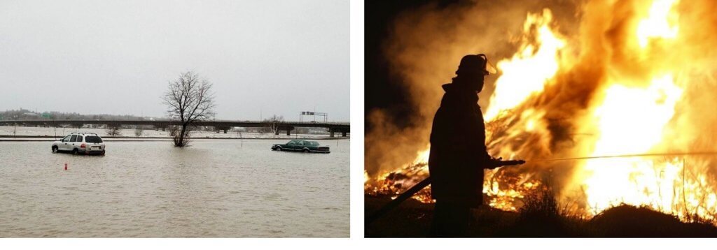
Canadians had plenty to “weather” in 2019: Winter froze and buried us; summer soaked and frightened us and, occasionally, baked us. It was the shorter spring and fall seasons that brought the most destructive and disruptive weather. Property damage from weather extremes cost Canadians millions and the economy billions of dollars. Based on preliminary estimates collected by the Insurance Bureau of Canada, there were 12 major catastrophic events, each with losses in excess of $25 million. For the eleventh year in a row, the Canadian insurance sector faced billion-dollar losses due to weather-related extremes.
The year 2019 was one of big floods, especially in Ontario, Quebec and New Brunswick. The Ottawa River flood was bigger and worse than the one in 2017. Everything about the flood, including its magnitude, duration and impacts, was unprecedented. For the second consecutive year, the Saint John River flooded in April and became one of the longest flood events in New Brunswick’s history. Significant flooding also occurred in central Ontario’s cottage country, on the shores of the Lower Great Lakes, and in Quebec’s Beauce region.
The absence of spring flooding in Manitoba’s Red River Valley made news when the basin was anticipating a major flood that did not materialize, owing to a favourable melt season. In contrast, heavy rain and snow in October resulted in flood warnings and high water advisories for some areas of Manitoba and triggered the latest activation of the Red River Floodway since it began operation.
This year featured several noteworthy storms. One that disappointed millions of children in Ontario and Quebec was the Halloween storm that cut short trick-or-treating, and even delayed it for some. Two early autumn snowfalls shocked residents in Calgary and Winnipeg and further delayed harvesting. During an active Atlantic hurricane season, Canada was touched by four tropical storms and was hit directly by Category-2 Dorian in September. The impacts of Dorian were made worse by the soaking rains and powerful winds from tropical storm Erin just a week earlier. While not as intense as Hurricane Juan of 2003, Dorian’s winds, rains and waves destroyed more Nova Scotia physical infrastructure than any storm in the past.
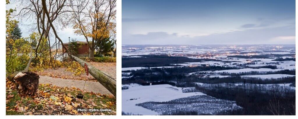
Storms in 2019 caused extensive power outages from coast to coast to coast. Over three million homes and businesses lost power not just for hours but, in some cases, for a week or longer. For British Columbia, the greatest outage in BC Hydro’s history occurred during the first week of winter (December 2018). In Manitoba, the public utility also faced the largest outage in that province’s history. In Quebec, the Halloween storm took out power for nearly a million customers, the impact second only to the infamous ice storm of January 1998. With Hurricane Dorian, Nova Scotia Power faced the single most damaging storm in its history, with 412,000 or 80% of their customers affected.
The year 2019 presented enormous challenges for food producers and the farming industry across the country. Farming became a year-long challenge for Western farmers and ranchers when it was too cool throughout the growing season and either too dry at the start or too wet in the fall, leaving the harvest (for some) to be completed in 2020. It was the worst-ever harvest for others who managed to complete it. For Eastern farmers, the growing weather was especially disappointing. Some farmers said they could have bought both flood insurance and drought insurance in the same growing season.
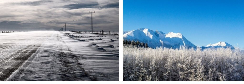
In 2019, Western Canadians proved their mettle as winter people by beating back a brutal cold spell in February, when the shortest month felt like the longest. Easterners were no less heroic, having to endure lengthy power losses. The forest fire season was generally quiet across Canada in contrast to the last two years. The exceptions were in Alberta and northwestern Ontario, where huge tracts of timber were burned in some of the largest fires on record.
In the rugged but fragile North, 2019 saw the Arctic continue its alarming warming and massive ice melt. Parts of the North experienced southern-like weather, such as heat waves, thunderstorms, tornadoes, wildfires and winter rains. Arctic ice cover shrank to its second lowest minimum extent on record (40 years).
It was another warm year (January to November, inclusive) in Canada. In fact, it was our 23rd “not-cold” year in a row, although it was not as warm as it has been in much of the past 10 years. Almost all of the warm-up was carried by the North, especially the northeastern part of Nunavut, which had its second warmest year in 72 years of record keeping, exceeded only by 2010. For millions of Canadians, it was not that 2019 was so cold—it just wasn’t hot. Apart from the Pacific coast of British Columbia, all of southern Canada, from Summerland to Summerside, felt a cooler year with temperatures slightly below normal. Much of the coolness was contributed by a frigid February and a summer that was more a teaser than a pleaser.
The year 2019 concluded the warmest decade on record in Canada. Average temperature for the ten‑year period (2010–2019) was 1.42 °C above the long-term conditions (1948–2019). Since the 1970s, each successive decade has been warmer than the last with the warming accelerating after 2000. Globally, 2019 was another warm year, according to the World Meteorological Organization (WMO), on course to be the second warmest year since modern records began 140 years ago, even without the help of a tropical Pacific El Niño. Further, 2019’s continued warming ensured the decade was the warmest in modern times.
From a list of 100 significant weather events happenings across Canada in 2019, events were rated from 1 to 10 based on factors that included the degree to which Canada and Canadians were impacted, the extent of the area affected, economic and environmental effects, and the event’s longevity as a top news story.
Top Ten Number 1. Another record-setting Ottawa River flood
Nature was all primed for another catastrophic spring flood along the Ottawa and St. Lawrence Rivers—the second record discharge in three years. Flooding on the Ottawa River is often a threat in the spring. In the past century, flooding has exceeded a flow of 8,000 cubic metres per second at Hawkesbury, Ontario, on eight occasions. But only twice, in 2017 and 2019, has the flow peaked above 9,000 cubic metres per second. This year’s flood was bigger than the 2017 event that was then considered the flood of the century. On April 5, Hydro-Québec reported that the dam at Chute Bell, Quebec, on the Rouge River (which feeds into the Ottawa River), was exceeding the dam’s specifications. The dam, built to withstand a once-in-one-thousand-year flood, saw water gushing over the top and around its sides, at eleven times its normal flow.
Everything about this year’s flood, including its size and duration, was unprecedented. All the weather ingredients were in place for a catastrophic event. Seven straight months of below-normal temperatures from October to April ensured the ground froze deeply and thawed late, preventing the infiltration of rain and snowmelt runoff. With little melting by mid-spring, the deep and icy snowpack stayed. In heavily forested areas upstream of the Ottawa River, snowfall accumulation was 50% greater than normal. Adding to this scenario were multiple rounds of heavy spring rains persisting over a five-week period from mid-April to mid-May. This included two storms from the Gulf of Mexico that brought an equivalent of a month’s worth of rain and triggered an immediate and lengthy spring flood. In Ottawa, twice the normal accumulation of rain, 150 mm to be exact, fell between April 10 and May 10.
It promised to be a long, drawn-out flood season along the rain-soaked Ottawa and Rideau Rivers and in Quebec along rivers such as the Rigaud, Mille-Îles and des Prairies. In mid-April, 20 to 40 cm of snow still lay on the ground in the northern reaches of the Ottawa River watershed. Incessant rains and warm air from the southwest assaulted the snow pack, causing rapid melting. On May 1, the bloated Ottawa River crested 30 cm above 2017’s peak flood levels. Water inundated several riverside communities, including Pembroke, Constance Bay, Fitzroy Harbour, Arnprior and Britannia in Ontario, and Pontiac, Gatineau, Rigaud and Laval in Quebec. Dozens of smaller rivers flowing into the Ottawa River also broke all-time flow records. For the second time in three years, homeowners, municipal workers, volunteers and armed forces personnel worked frantically to fill sandbags, build makeshift walls, pump water from homes, and assist first responders in evacuations. Hundreds of residents from Pembroke, Ontario, to Sherbrooke, Quebec, and on to the Beauce, Quebec, region were forced to leave their homes despite sandbagging efforts. In Ottawa and Gatineau, more than 6,000 dwellings were flooded or at risk. Roads and streets in flooded areas closed for long periods. Several bridges, including the Chaudière between Ottawa and Gatineau, also closed, and many of the ferry services were suspended. Farmland was flooded, delaying fieldwork and planting. Downstream in Montréal, the flood emergency remained until May 8. It took Ottawa more than a month longer to lift their state of emergency. The flood claimed at least two lives: one each in Ontario and Quebec.

Top Ten Number 2. Active hurricane season as predicted
The 2019 Atlantic hurricane season was one of the world’s most devastating, with many casualties and widespread destruction in the Caribbean. Post-tropical depression Erin reached the south shore of Nova Scotia on August 29, merging with a trough of low pressure arriving from the west. At its peak, this hybrid storm’s rainfall rates exceeded 30 mm per hour, triggering flash flooding with ponding and washouts.
A week later, Hurricane Dorian arrived on the scene. Dorian was the most destructive storm of the season both outside and inside Canada. With winds of nearly 300 km/h, it destroyed parts of Grand Bahama and the Abacos before it crawled adjacent to Florida and Georgia and made landfall in North Carolina. On September 7, a weakening Dorian raced northeastward toward Canada. As it neared Nova Scotia, Dorian transitioned into a post-tropical storm but maintained its Category 2 intensity with sustained winds of 155 km/h before making landfall just west of Halifax after 7:00 p.m. Post-tropical storm Dorian pounded Atlantic Canada with heavy rains, winds, storm surges, and high significant waves over the 24-hour event on September 7 and 8. Some century-old trees in full leaf suffered a swift uprooting, often landing on homes and vehicles. Nearly half a million people were without power across Atlantic Canada. Eighty per cent of Nova Scotia’s homes and businesses lost power—the highest number of outages in Nova Scotia Power’s history. Dorian seriously hampered crops almost ready for harvesting in what had already been a difficult growing season. Authorities claimed that the physical infrastructure damage across the province of Nova Scotia was unprecedented. As a result of excellent preparation by citizens and emergency managers, there were no serious injuries or direct fatalities. Rain totals were 100 mm in many places, with an observed maximum of 190 mm west of Halifax.
Dorian brought destructive winds to other parts of the Maritimes as well. Storm surges generated extensive flooding in some coastal areas along the Northumberland Strait. In New Brunswick’s Shediac region, winds and storm surges lifted dozens of vessels and carried them onto the shore. The Magdalen Islands and Gaspé Peninsula were severely impacted, as homes, cottages and boats were damaged and trees uprooted; in some cases, cottages and outbuildings were blown off their foundations. As Dorian tracked its way to Newfoundland and Labrador, its impacts were mostly from the wind. The western and southwestern parts of Newfoundland and Labrador felt the strongest winds, topping 157 km/h in the Wreckhouse area. Dorian also produced a behemoth 30 m wave just a little ways offshore from Port aux Basques, Newfoundland. Early estimates from the Insurance Bureau of Canada indicate that Hurricane Dorian caused a trail of damage to insured property estimated at $140 million, with nearly two-thirds of the damage occurring in Nova Scotia.
Other Atlantic tropical storms affected life in Canada. Early in the summer, the remains of Hurricane Barry caused urban flooding in West Toronto. Hurricane Humberto passed through Canadian waters as a post-tropical storm on September 21. Tropical storm Jerry didn’t make landfall anywhere in Canada but brought rains in the 40 to 60 mm range on September 24–25 across parts of western New Brunswick, Prince Edward Island and northern Nova Scotia. Parts of Newfoundland and Labrador also got upwards of 100 mm of rain. The rain backed up drains still clogged with debris left over by Dorian. In the last week of October, the remnants of Tropical Storm Olga yielded up to 50 mm of rain and southwesterly winds, raising water levels on some exposed shores of Lakes Erie and Ontario.
Top Ten Number 3. sNo-good Prairie fall
Snow in September is not rare in Calgary, and about two-thirds of its annual snowfall usually occurs in the fall and spring seasons. But for four days at the end of September, Calgary was assaulted by a bout of wintry weather with sub-freezing temperatures and snow. The four-day snowfall totaled 32 cm. While not a record dump, Calgary did see the greatest depth of snow on the ground in 65 years for late September. Over the foothills, heavier snowfalls fell at more intense rates, with upwards of a metre of snow accumulating in the higher terrain of Waterton Lakes, Pincher Creek and Crowsnest Pass.
The heavy, wet snow created huge traffic problems. Several universities and colleges closed, public services shut down, and air travelers faced delays and flight cancellations. Trees still flush with green leaves bowed, sagged and snapped from the weight of sticky snow. Snow accumulation on power lines and branches led to widespread power outages. Outside Calgary, especially to the south and west, farmers and ranchers braced against more killing frost and heavy, wet snow that beat down crops. In southern British Columbia, the early blast of winter also brought 35 to 50 cm of snow across several mountain passes. Eventually, the storm moved eastward, bringing much less snow to southern Saskatchewan and only rains to Manitoba.
Two weeks later, heading into the Thanksgiving Day weekend, Manitobans were still drying out from record September rains, nearly three times the norm. Farmers were especially concerned but, after a relatively dry first week of October, they once again started up their combines and resumed round-the-clock harvesting. They were keeping an eye on a pending well-announced weather system. The storm sat over the region for days. Heavy, sticky snows draped Manitoba from Brandon to Winnipeg from October 10 to 12 and through the Thanksgiving weekend. Historic snowfall totals included 34 cm at Winnipeg over two days, making it the biggest October snowstorm in the city since records began in 1872. States of emergency were declared across the province and in eleven communities, including Winnipeg. More than 6,000 people had to evacuate from a dozen or more First Nations communities. Lengthy and widespread power outages created hardship. Powerful winds exceeding 80 km/h drove the wet snow, creating blinding blizzards and two-metre drifts. In some cases, transmission towers toppled, downing total electrical grids. According to Manitoba Hydro, at the peak of the storm, a quarter of a million people were without power, making it the largest outage in the utility’s history. Ten days later, about 5,000 were still without power. By the end of November, there were still some citizens who could not yet return to their homes.
The storm’s early arrival in October meant tree branches, still loaded with leaves, were bending. Many of Winnipeg’s trees saw damage and loss under the weight of the snow. Over 30,000 trees on public land were affected, with estimates of thousands more on private land. The Manitoba escarpment in Morden, Winkler, and Carberry also saw between 50 and 75 cm of snow.
Top Ten Number 4. A brutal Febrrruary in Canada
The Polar Vortex prevailed across Canada and helped to define a long winter! El Niño was expected to tame winter across North America, but it was late to arrive and its effect on weather patterns was weak. Instead, Arctic weather pushed southward for six weeks, from late January and throughout February, with a continuous supply of cold air.
For half the country, from the Pacific Coast to the Upper Great Lakes, February was the coldest month in at least 70 years. Along the Pacific coast and the BC interior, temperatures were 9 degrees below normal and nearly 1.6 degrees colder than the previous coldest February, in 1949. Calgary had its coldest February in 83 years, and Alberta’s Chinook Country was 14 degrees colder than normal. The February mean temperature in Calgary was an astounding 10 degrees below normal—the greatest monthly departure from normal ever for anywhere in the Prairie provinces. Toronto saw a year’s worth of snow in the first two months of the year with only 10 days without precipitation in January and February. Montréal saw 9 days of thaws and freezes in February, meaning that liquid on the ground during the day turned to ice overnight, leading to an inordinate number of slips and falls, causing injuries ranging from sprains to concussions. In Atlantic Canada, it was the third coldest February in 25 years. Just too much winter went on without a break!
At the same time, homeless Canadians filled all available spaces in emergency shelters. Often, mail carriers and couriers were unable to carry out their duties. New power consumption records were set, only to be eclipsed the next day. Mechanical problems dogged public transit systems. Buses broke down, often forcing schools to close for several consecutive days. Cities faced hundreds of calls for service on leaky and broken pipes, with frost levels well below pipe depth. For example, Regina reported a record number of water main breaks—fifty-two, compared with the five-year average of seventeen for February. Piercing cold, ferocious winds, ice, and mountains of snow piled up on front yards and even higher along curbs and driveways. The shortest month will be remembered for one of the longest cold snaps in years.
Top Ten Number 5. Record heat continues in Arctic
With many consecutive warm years, the Arctic is seeing less snow, permafrost slumping deeper, sea ice thinning, and high-latitude glaciers retreating. Increasing temperatures above and below the ice caused a further reduction in ice concentrations, from its maximum extent in March to minimum amounts in September. This September, Arctic sea ice reached its annual minimum at 4.15 million square km—the second lowest minimum extent on record, tied with the minima observed in 2007 and 2016, and behind the record set in 2012. According to the Canadian Ice Service, the pattern of reduced ice coverage was observed in northern Canadian waters, with maximum and minimum ice cover attained in mid-May and late September, respectively. Freeze-up in the fall was the latest on record (since 1979), primarily due to the extraordinary warm spell spanning ten weeks starting in early September.
From Alaska to Greenland and in Canada, the North American Arctic experienced above average temperatures at a record level throughout the year. The same July heat wave that originated over North Africa and surged northward to roast Europe continued into the Arctic. Summer temperatures in the High Arctic, according to Environment and Climate Change Canada’s trends analysis, ranged between 2.5 °C and 4.5 °C above what is normal for Nunavut, making it the warmest summer in 72 years.
The first half of winter saw very little snow across parts of Nunavut. On the tundra, Indigenous hunters reported that rocks and gravel—typically covered by a hard layer of snow—were exposed. Just days before the first day of spring, southerly winds brought unseasonable warmth and abundant sunshine to the North. The Yukon and Northwest Territories broke more than 90 maximum temperature records over one week in March, with some records eclipsing the previous record by 3 to 6 degrees. By April 11, the ice road connecting Dettah and Yellowknife closed for the season due to rapidly deteriorating conditions when temperatures exceeded 20 °C. It was the earliest closure of the ice road since 1993. Other ice roads also had to close prematurely. On June 2 around 4 p.m., eyewitnesses spotted an EF-1 tornado near Fort Smith, Northwest Territories. It was the fourth tornado ever confirmed north of 60° latitude in Canada. The Canadian Forces Station Alert, Nunavut—a military outpost and the most northerly permanently inhabited spot on Earth—experienced an “Arctic heat wave” in mid‑July when temperatures exceeded 21 °C, 14 degrees warmer than normal. It was warmer in Alert that day than it was in Victoria, British Columbia! On the afternoon of August 10, multiple lightning strikes occurred within 500 kilometres of the North Pole in a rare Arctic thunderstorm. Wildfires in the Yukon began early, stayed later, were hotter, bigger and moved more quickly. The total area burned was 2,800 square km, more than double the territory’s 10-year average. Wildfires visible from space also occurred north of the Arctic Circle near Inuvik, Northwest Territories.

Top Ten Number 6. On the Prairies…Too dry early, too wet later
Prairie farmers and ranchers had another challenging weather year in 2019. It was too cool and dry in the beginning and too cold and wet at the end. Before the growing season even got underway, ranchers and farmers were facing some of the driest winter-spring conditions in 133 years of record keeping. In some of the southern regions, the amount of moisture and rain had been running low for more than two years. Edmonton, Alberta, experienced its driest spring on record. Regina, Saskatchewan, saw its driest March with just 0.8 mm of precipitation. Saskatoon, Saskatchewan, was even drier in April with 0.4 mm of precipitation. Winnipeg, Manitoba, recorded its driest first half year with only 91 mm of total precipitation; the normal January-to-June total is 235 mm. In those cities, homeowners were seeing their foundations cracking, shifting and sinking in the abnormally dry ground. Record cold, especially in February that continued into March and April, had already delayed seeding and slowed crop growth. The Prairies welcomed scattered rains in July, but pockets of drought continued in the southern area, leading to a shortage of feed resources, which carried over from 2018. Stunted grasses forced ranchers to either sell off part of their herds or start using winter feed, months early.
The much-needed moisture in mid-summer through the fall initially raised spirits among rural Westerners but, unfortunately, the rains didn’t stop until the Prairies had gone from dry to drenched. Regina saw nearly 175 mm of rain in August and September, bringing 100 mm more than normal, making it the second wettest August/September in 136 years. Frequent, heavy rain events often left fields saturated and incapable of handling heavy farm equipment. Residents on the Prairies witnessed double the normal number of severe summer weather happenings with tornadoes, intense rainfalls, windstorms and 2.25 times the usual number of hailstorms, but no place exemplified the summer misery more than Edmonton. Through June, July and August, inclusively, Edmonton’s city weather station had 55 days of rain, the second highest number of days since 1881. Further, there were only 18 days in 2019 in which temperatures climbed in a summery way to 25 °C or above.
In central Alberta, crops were drowning, pastures were under water and ditches were full and overflowing. The wetness led to major crop losses, especially hay. Farmers were desperate for warmer, windier and sunnier weather to dry things out so that they could begin harvesting. Instead, they got overcast skies, cold temperatures, and continuous showers with more hail. The stress and strain reached the breaking point for thousands of producers, their families and communities. As rains persisted in September and October, farmers grew even more anxious. Huge tracts of land received double the average August-to-October precipitation. The historic mid-September snowfall that struck Alberta and western Saskatchewan, followed by more snows and rains in October, caused the majority of the Prairie crop still in the fields to deteriorate and prices to fall. Grains began to show sprout and mildew. Never had so much crop—from canola to potatoes to sugar beets—been out so late.
Top Ten Number 7. Weather witch stole Halloween
The forecasts for the evening hours of October 31 are scrutinized more than most other evenings. For millions of children and their parents, the weather forecast on Halloween night is used to make decisions from what to wear to what route to take and for how long. This year, with notice of a significant Halloween storm coming several days in advance, some municipal leaders contemplated whether or not to postpone Halloween.
Following rain showers the previous day, a second round of more intense rainfall moved through Central Canada on Halloween and into Atlantic Canada through the morning of November 1. At the same time, snow fell on the northern side of the system, stretching from Northeastern Ontario to north-central Quebec and across to Labrador, with powerful winds across the East.
Twenty Quebec municipalities postponed trick or treating until the next day. Millions of children exchanged an evening of trick or treating in the rain for high winds blowing them around in total darkness the following evening, after damaging winds accompanied plunging temperatures as the heavy precipitation came to an end.
Winds at Port Colborne, Ontario, peaked at 129 km/h. Along the shores of eastern Lake Erie and Lake Ontario, high waves and storm surges caused extensive property damage. Montréal, Trois-Rivières and La Pocatière, Quebec, recorded gusts over 104 km/h. Halifax, Nova Scotia, recorded a wind gust of 102 km/h. Newfoundland winds intensified on November 1 and sped along at 107 km/h at Wreckhouse and 100 km/h at St. John’s.
The strong winds downed power lines and trees, causing the lights to go out for nearly two million Quebecers on November 1. It was the biggest service interruption in the province in more than 20 years. Power outages were especially widespread in Montréal, the Montérégie, the Laurentians, the Eastern Townships, Lanaudière, and the Beauce–Québec City region. Soaking rains also triggered flooding in the downtown core of several communities, including Sherbrooke, where more than 100 mm of rain swelled the Saint François River by more than seven metres, prompting evacuations from 250 buildings. The cities of Granby, Sherbrooke, and Drummondville appeared to take the brunt of the storm’s wrath, with both the greatest rainfall and strongest winds centred in that region of southern Quebec. Property losses totaled several million dollars from downed trees and damaged roofs and siding. Authorities confirmed four deaths in Quebec.
For much of Eastern Canada, the Halloween storm was also a season-changer, as it ended what had been a warm fall, ushering in lasting November cold and winter’s first snowfalls.
Top Ten Number 8. Spring missing in the East
Following one of the coldest Februaries in decades, Canadians were ready for spring. Yet “real” spring was more winter-like across Eastern Canada. The culprit was the dreaded Polar Vortex that lingered well past April. Persistent northerly and westerly winds kept spring air cold with ample overcast skies, cold rain, and even snow at times. Spring was colder than normal from Alberta to Atlantic Canada.
Over the Great Lakes and St. Lawrence Basin, spring was the second coldest in 22 years. Simply, most Canadians had to wait until summer for spring’s arrival. The lack of sun and warmth and weeks of continuous rains caused concern among farmers, gardeners and golfers: spring might have been the cruelest season ever this year. On the first day of summer, many fields and golf greens in the East were either under water or still saturated from non-stop rains. Standing water covered swaths of recently planted corn and soybeans. Farmers could only watch as the plants rotted. Some growers were set back weeks, some never caught up and some scrambled to choose a different crop. In the East, it was one of the latest planting seasons ever. By the long weekend in May, less than 5% of Ontario’s crop was in the ground. Some seeds were sown but nothing was growing except grass. The agriculture-rich Annapolis Valley of Nova Scotia recorded nearly triple their April rainfall and suffered the coldest soil temperatures in 20 years.
May was also colder than normal, which meant less evaporation and drying. In Moncton, New Brunswick, May’s average temperature was 7.6 °C, significantly below the normal of 10 °C. Heat for growing food and flowers was less than 40% of normal in May, disappointing many farmers and gardeners. The 2019 planting season was the latest in 40 years, some three weeks behind schedule, raising concerns for crop damage from an early frost and/or high ground water content at harvest. The weather being the farmers’ worst enemy in the spring, it turned out to be their best ally in the fall with enough sunny, warm and dry weather to save what could have been a disastrous crop.
Cities were impacted by the lack or delay of spring. Sports fields were drenched, forcing thousands of practices and games to be rescheduled. Golf courses opened late but stayed empty throughout spring: some golf superintendents lamented the conditions, calling them the worst in at least 15 years.
Top Ten Number 9. Saint John River floods again
At the beginning of March, provincial river forecasters in New Brunswick were on watch. In the northwest of the province, where it had been snowing since late October, the snow pack was much deeper than average and ahead of last year’s amount by nearly 20%, when the river recorded a record flow in some places. Further, the frozen ground was unable to absorb spring rain. Spring weather is really the big flood determinant—a cold stretch slowing snowmelt, followed by sudden warming and rapid, round-the-clock thawing, compounded by heavy spring rains, often create significant flooding. With that weather outlook in hand, residents in dozens of communities close to the Saint John River spent Easter preparing for the worst.
The weather in April indeed brought on the flood. In Fredericton, precipitation was nearly double April’s average with six more wet days than normal and twice the number of heavy rain days. From mid-to-late April, a series of storms brought mild temperatures and significant rains that worsened the prospects for flooding. From April 18 to 28, up to 130 mm of rain fell along the Saint John River. The snowpack in New Brunswick and Maine melted rapidly. On April 22, the Saint John River at the Maine–New Brunswick border had its largest peak streamflow in 67 years. Farther downstream, the peak river level in Fredericton was 8.37 m, surpassing 2018’s water level and making it the second highest level on record behind 1973. Other stations downriver from Fredericton came close to exceeding historical levels. The river, at many locations, remained near or above flood stage for about two weeks, making it one of the longest flood events in history.
The Saint John River ran cold and fast and carried waste and debris. Thousands of riverside residents scrambled to protect their properties. The military was called upon to help emergency crews and volunteers fill sandbags, build retaining walls, and help first responders with 1,500 evacuations. In the end, more than 16,000 properties were impacted by floodwaters. More than 145 roads were closed, including a portion of the Trans-Canada Highway between Fredericton and Moncton for seven days, requiring a 90-km detour. Schools and offices were also closed. New Brunswick has battled three major floods over the past 11 years, including this year’s and one last year that would once have been called hundred-year floods. More advanced warning, preparations and lessons learned from 2018 helped lessen the flood impacts and costs in 2019.
Top Ten Number 10. Fewer fires, more burning
Statistics from the Canadian Interagency Forest Fire Centre revealed a relatively quiet fire season in 2019. The number of fires nationally was down by 2,600, or 40%, compared with a record in 2018, but the number of burned hectares of woodlands was only 20% less than last year. Despite fewer fires, they burned more on average than last year’s infernos. Mitigation work, such as ridding the forest floor of dead brush, helped to prevent more fires from taking hold.
A notable exception to the quiet wildfire season was Alberta. The number of fires was on par with 2018, but the area that fire consumed was nearly 14 times greater, making it the second worst season on record. In May, the “Spring dip”, when trees and grasses have low moisture content, was underway, and hot, very dry, strong gusty winds came early. Around mid-May, the Chuckegg Creek fire erupted near the town of High Level, in far northwestern Alberta. Four thousand residents were evacuated as a result of the fire. By the end of May, 10,000 Albertans were out of their homes. Smoke from northern fires caused poor air quality and reduced visibility in parts of Alberta, northern British Columbia, and the Yukon. In particular, skies in Calgary and Edmonton were an eerie-grey-orange and air quality was very poor. By June 3, the Chuckegg Creek fire had grown to 280,000 hectares and was not considered held until the end of July, making it one of the longest wildfires on record. Fires in Alberta burned 883,000 hectares this year, making it the second greatest area burned in 60 years, and four times the 25‑year average.
In northwestern Ontario, a dry May contributed to prime forest fire conditions near the community of Pikangikum in the early summer. Heavy smoke from wildfires affected air quality in several First Nations communities for nearly two weeks, prompting the evacuation of 2,500 residents. Another blaze in early July, dubbed Red Lake Fire 23, occurred near the community of Keewaywin, forcing over 400 residents to be flown to rescue centres as far away as Regina. Forest fires in Ontario were half the number compared with the 25-year average, but they burned twice the average area.
In contrast, British Columbia, whose last two wildfire seasons featured in Canada’s Top 10 Weather Stories, got a bit of a break this year. In the spring, there was concern over the province’s winter snows that were about half their normal quantity, their lowest in 40 years. A record number of lightning strikes in summer across the province were also of concern. In total, 422,000 lightning strikes occurred, compared with the average of 266,000. Thankfully, the lightning was accompanied by considerably wet weather. A dry spring initially led to an early start to the fire season. Fortunately, less extreme temperatures and frequent cool, damp and cloudy weather worked against short heat bursts and dry spells to squelch fires. Wet weather in July was the saving grace, with up to double the rainfall in places. In the end, the area consumed by wildfires was about 0.02% of the area burned in each of the past two summers. The fire season was so slow that fire crews from BC were redeployed to help extinguish fires elsewhere in Canada.
Regional weather highlights
Atlantic Canada
- New Year’s Day takes Newfoundland by storm
- January maritime storm included every type of weather
- Winter storm forces Moncton residents outside
- February storm causes road closures in Labrador
- Pre-Valentine’s storm across the Maritimes
- March starts out stormy in Nova Scotia
- Newfoundland’s icebergs please tourists and locals
- Nain cut off by August fog
- October “weather bomb” drops lots of rain
Quebec
- Cold and snow close Montréal festival celebrating…cold and snow
- Miserable Valentine’s Day weather
- Made in Texas “bomb cyclone” explodes over Quebec
- Double storm leads to major spring flooding in Montréal
- Freezing April showers darken Quebec
- Two July tornadoes hit campgrounds
- Beauce flooding
- September tornado maple blowdown
- October nor’easter (weather bomb) brings outages and uprootings
- Remembrance Day record snow dump
Ontario
- Never too cold to snow
- February cold-melt-flash freeze in southwestern Ontario
- Toronto’s rare “snow day”
- Nasty winter storm closes Hwy 400
- Two rainstorms lead to major spring flooding along the Grand River Basin
- Record snows in Sudbury
- Great Lakes record high water flooding
- Historic Muskoka flooding
- Ottawa’s second tornado in nine months
- Ontario’s hot and humid summer day
- Lake Erie inland flooding caused by swollen Great Lakes
- Remembrance Day pre-winter storm
Prairie Provinces
- Winnipeg’s February snow scare
- Alberta March fog delays flights
- Biggar wildfire burns popular nature area
- Red River flood risk downgraded by “slowest melt ever”
- April whitewasher welcomed by farmers closes the Trans-Canada Highway
- Saskatchewan welcomes rain – most plentiful in three years
- Saskatchewan park tornado
- Rescue rains in Manitoba
- Eston Saskatchewan thunderstorms
- Winnipeg’s deadly heat
- Alberta’s overactive tornado and thunderstorm season
- Hailer of a year in Alberta
- Bummer of an Edmonton summer
- September monsoon floods Manitoba
British Columbia
- British Columbia winter windstorms
- Record rains and snowfalls lead to flooding
- Winter’s snow all in February – Victoria and Vancouver
- British Columbia’s March heat wave
- Snow drought lessens flood risk
- The Eagle Bluff fire – BC’s big one
- Record lightning but fewer fires
- Waiting to squeeze Okanagan grapes
- Two-week drought in Vancouver
- “Pineapple express” brings warm rains to the West Coast
The North
- Iqaluit windstorm delays Prime Minister’s trip
- Territorial heat wave in March
- February in August?
More Like This:
David Phillips, Environment and Climate Change Canada, Saint John River flood, top ten weather stories, Weather Extremes